Reuss Valley Uri
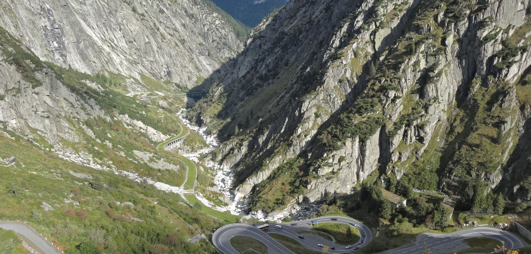
Natural hazard such as flooding, avalanches or rockfall are fundamental topics in the Reuss valley of canton Uri.
In order to demonstrate the functions of protection forests to the students an experiment in a potential rockfall area was designed. The objective of this experiment was to illustrate the effect a forest can have in a rockfall event.
Task
How wide does a forest strip have to be to retain boulders of different sizes (here: 0.25 - 2.00 m3)?
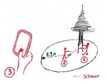
In order to answer this question, the students were asked to characterize the forest quantitatively by taking samples. For this they had to locate a specified sampling centre and record the diameter at breast height (DBH) of all trees with a DBH bigger than 10 cm that were within a radius of 9 m (area ~250 m2) from this sampling centre.
The data were evaluated in two ways: the average for the DBH was calculated and the number of trees was extrapolated to the hectare. For the latter the number of measured trees was multiplied by 40 (250 m2 correspond to 1/40 of a hectare). These two values are input parameters for a simple rockfall model that enables the determination of the theoretical forest strip width.
Field experiment
The experiment was carried out with the Collector for ArcGIS app. Additionally, the students received a nine meter long string and a DBH measuring tape.
Crowd-Sampling Phase
18 students took part in the excursion. For the experiment the students were split into groups of three. One person functioned as the sampling center, a second person decided if a tree was within the sampling radius and measured the DBH. The third person recorded the information digitally with the Collector for ArcGIS app.
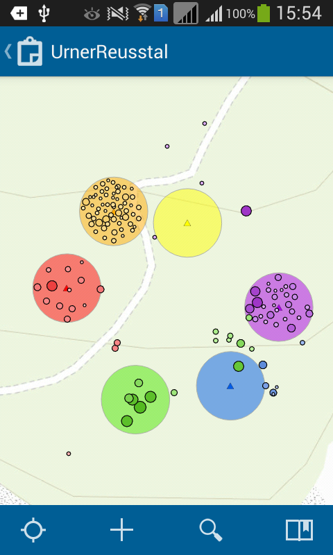
Data recording took between 20 to 30 minutes. In this time a total of 173 trees were recorded.
The number of recorded trees and their average DBH per sampling circle could automatically be calculated with the app. Subsequently, the students were asked to determine the number of trees per hectare. Based on the input parameters and with the help of a nomogram the theoretical forest strip width for boulders of different cubing could then be identified.
Discussion
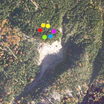
This experiment illustrates that the forest can be characterized by recording samples which enables an observer to make plausible statements about the forest's protection function against natural hazards. The spatial variation of this protection function could be revealed with the recorded six sample circles between which the forest structure varied strongly.
Feedback
"It surprised me, how easy it was to handle the app and that in such a short period of time - in spite of the inaccuracy of the GPS-signals - the recording of several trees within a sample circle was possible. Since the exact position of the trees at the level of the sample circles was not relevant for the calculation of the parameters, the exact GPS-signal was not important. Therefore, it was possible to convey a sound insight into the quantification of a forest's protection function to the students. At the same time, the problem of GPS-inaccuracy in forests could be highlighted and discussed." (Dr. Jochen Breschan, Institute of Terrestrial Ecosystems, ETH Zurich, 2015)
Feedback from the students does unfortunately not exist for this experiment.
Lesson Learned
The positional inaccuracy of the GPS-signals of up to 30 m in the forest lead to confusion amongst the students. Since the position of the single trees in this examples is irrelevant for the calculation of the forest's protection function, the recording of single trees will not be carried out in this way the next time. Instead, when repeating the experiment, the DBH values will be directly added to the sample circle's centre. Like this the confusing point pattern of tree positions will be avoided. In addition, more time is required for the evaluation phase so that enough time can be allocated to the discussion.


